FULL HANDBOOK
Chapter 1: Industry Overview
Chapter 2: Geology & Site Selection
Chapter 3: Drilling & Blasting
Chapter 4: Excavating & Loading
Chapter 5: Hauling
Chapter 6: Crushing & Hydraulic Breaking
Chapter 7: Screening
Chapter 8: Washing & Classifying
Chapter 9: Conveying & Material Handling
Chapter 10: Loadout & Weighing
Chapter 11: Safety & Health
IN THIS CHAPTER
Site Selection
Ultimately, the selection of a mine site to produce aggregates depends on one key factor: location.
Several factors make a location desirable, but the decision mostly depends on the market’s supply and demand needs for construction materials.
Transportation costs are vital to supplying a market area. Transportation is not economically viable over great distances and must be evaluated against appropriate geological materials, competitor locations and permitting restrictions for greenfields.
PRO TIP
Factor in transport costs: Even the best deposits may be unviable if located too far from the intended market.
Also, a professional geologist with aggregate exploration experience is critical to locate and prove a deposit for aggregate use.
All stone, sand and gravel underlying a property may not be usable for aggregates. Some rock types do not meet the required physical specifications.
For example, stone may be too soft or break down due to freeze and thaw conditions. In addition, overburden overlying stone may be too thick to mine economically.
Also, deposits underlying potential sand and gravel properties may have too much clay or silt to be utilized as acceptable aggregates. Therefore, understanding the geology and the end-use of aggregate products is essential.
&uuid=(email))
Identifying market areas
While local market factors are the primary driver of aggregate demand, geology is very important.
The geology may be ideal in one place in the U.S., featuring plentiful reserves and material that can meet a variety of construction material specifications. But if a site is positioned too far from the market, it will be difficult – if not impossible – to develop an economically viable site.
Conversely, even if a market exists where construction materials are in high demand, potential mining sites that are viable may be in short supply or not economically viable.
Another key aspect of site selection is determining demand for different types of construction materials. For example, if a market is experiencing a residential construction boom, then there will undoubtedly be increased demand for concrete aggregates.
Concrete requires a component of sand. If no natural sources are locally available, then it may be necessary to use manufactured sand. This will increase processing costs.
Chemical-grade stone that’s high in calcium or magnesium is sourced from carbonate rocks such as limestone and dolostone. Identifying carbonate rock sources that meet stringent chemical-grade specifications will severely constrain the number of potential sites for such a resource.
PRO TIP
Match resources to end use: Hard quartz-rich rocks may be ideal for skid- resistant asphalt, while carbonate rocks can supply chemical-grade stone.
Additionally, aggregates used in asphalt require a certain threshold of skid resistance. For that kind of material, rocks with harder minerals such as quartz make a better skid-resistant aggregate.
Softer carbonate rocks are not necessarily ideal for such applications, but aggregate testing may find that these materials meet the necessary thresholds for secondary roads or aggregate base.
PRO TIP
Validate with lab testing: Standardized tests confirm whether material meets department of transportation or project specifications.
Population growth and future demand projections are useful to determine which areas may demand aggregate supply in the future. Many of these estimates are available from the U.S. Census Bureau and state commerce departments.
Typically, larger growth transpires along major interstate corridors and with the expansion of existing cities. State departments of transportation utilize these estimates to plan for future road improvements and additions.
Exploration
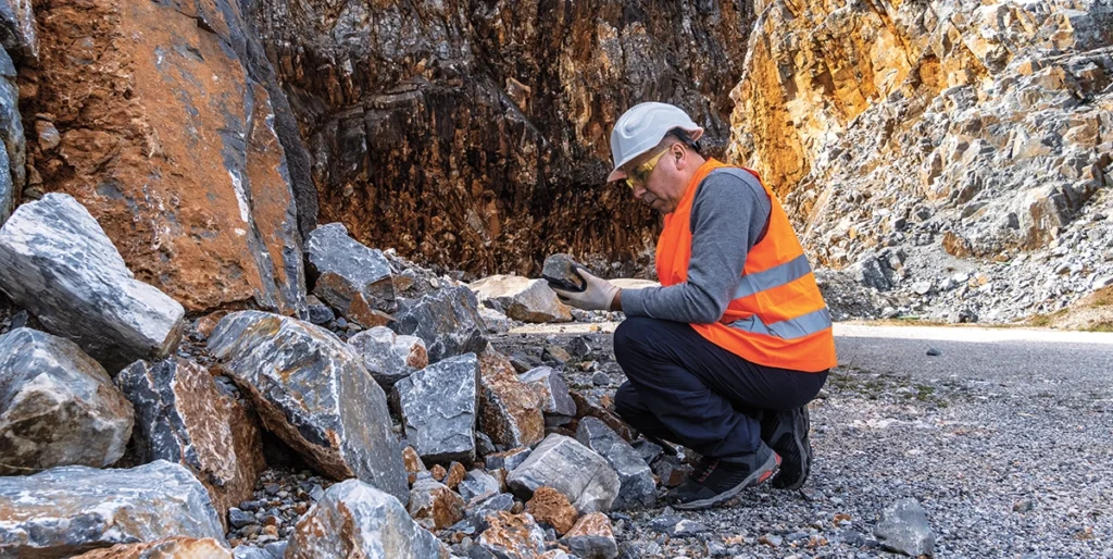
While geologic maps, aerial photography and topographic information all contribute to site selection, an initial field investigation has no substitute.
Once a candidate site is identified and access to the property arranged with the landowner, field examination can begin. The equipment necessary for basic fieldwork includes a GPS unit, a Brunton compass, basemaps, a field notebook, a hand lens and sample bags.
PRO TIP
Start with surface mapping: Simple field observations can reveal outcrops, soil profiles and key indicators of aggregate potential.
The GPS unit records the location of sites where surface samples are collected. A detailed geological map of the property may even be constructed, depending on the quality of bedrock outcrops or exposures of surficial materials.
The Brunton compass allows for taking structural measurements of any bedding, foliation and faults that are exposed. If surface exposures seem suitable and collected materials meet the basic aggregate quality specifications, a drilling program can be planned to better understand material quality in the subsurface.
Before embarking on the subsurface phase of the exploration, it should be stressed that drilling, trenching or geophysics should be done on appropriately spaced intervals. The spacing depends on the consistency of the formation and the characteristics required of the end products.
For example, exploration drilling is typically done on wide-spaced centers, and tighter drilling patterns are necessary for developmental drilling projects after permitting is completed. Tighter spacing is required to obtain accurate stripping volumes or specific whole-rock chemistry for selective mining.
PRO TIP
Think long-term in drilling: Wider spacing works for initial exploration, but tighter grids are needed before final mine planning.
Trenching can be employed to locate shallow rock exposures for mapping and sampling – especially if selective mining is required for varying rock types. In addition, trenching can be used to identify overburden depths to the top of rock, to determine sand and gravel thickness, and to sample various lithologies for quality testing.
Auger drilling is a method utilized to identify overburden thickness or sand and gravel thickness. It is a fast, economical method to evaluate a site’s viability. Auger drilling for quarry sites alone is not recommended, though.
PRO TIP
Use multiple exploration methods: Combine trenching, auger drilling, core drilling and geophysics to build a more complete resource picture.
Sonic drilling is another method to collect samples. This method is utilized to sample unconsolidated soils and rock. It is very useful in sand and gravel exploration to obtain undisturbed samples with larger-diameter gravels.
Core drilling is a method to collect rock samples for rock-type confirmation, mineralogy, geologic structure and rock quality testing.
Air rotary drilling, meanwhile, can be performed quickly and economically to evaluate overburden depths and rock types. This drilling type pulverizes rock into small chips. Rock cuttings are usually useful in identifying rock-type contacts. Unfortunately, they are too fine to test for most typical department of transportation coarse aggregate test methods.
In some situations, drilling may be prohibitively expensive – or it may be difficult to get equipment into interesting areas of the property. Geophysical methods use techniques such as seismic, electrical resistivity, microgravity and ground-penetrating radar to image the shallow subsurface.
The primary goal of these techniques in a resource assessment is largely to identify the thickness of overburden material and the location of zones of intense faulting or fracturing. It is also useful to identify zones of deep weathering or contacts between varying rock-type compositions for selective mining purposes.
Aggregate testing methods
Several physical tests can determine the suitability of aggregates as a resource. State departments of transportation have standard specifications for aggregate test methods and required test results. Core or stone samples can be evaluated through a variety of tests:
- Los Angeles (LA) test. This tests the hardness or durability of the stone.
- Magnesium or sodium sulfate loss tests. These replicate the freeze/ thaw cycle of seasonal temperature changes.
- Absorption. It’s useful to determine the suitability of an aggregate source with asphalt. Typically, a stone with high absorption suggests a porous stone, which usually has a high-sulfate loss.
- Specific gravity. This is necessary to calculate the tonnage of a proven resource. Concrete and asphalt producers prefer a lower specific gravity rock due to the lower volume required for the same higher specific gravity rock, which makes it more economic for the producer.
- Alkali-aggregate reactivity. This test determines the suitability in high-alkali cement for concrete use. Reactive minerals can still be utilized in concrete aggregates, but they will most likely require fly ash or other additives to mitigate the alkali-aggregate reaction.
- Flat and elongated particle shape. This determines how the stone is situated within concrete and asphalt. Typically, a flat particle shape tends to float, giving a preferred orientation and lower concrete strengths. This method requires hand samples or quarried samples. A geologist can evaluate the core to determine if this might be a problem.
- Petrographic Examination. This test evaluates a stone for mineralogical composition. An examination can assist with the identification of minerals that can contribute to alkali-aggregate reactivity potential and other mineralogical issues that can cause problems in aggregates or health issues relative to exposure to the public.
- Compressive and tensile strengths. These are useful to identify rock crusher liner types and concrete strengths.
- Chemical analyses. These evaluations are useful to characterize the chemical composition of resources that may serve as sources of chemical-grade stone. Customers may also require chemistry data for any aggregates supplied as a matter of standard protocol.
- British polish test or other skid-resistance test methods. These determine the polishing characteristics for use in surface-treatment asphalt or concrete.
Permitting and zoning
Successfully finding and opening a greenfield site is not easy to accomplish.
Zoning restrictions, which most counties have in place, will necessitate property rezoning for mining. This usually requires a public hearing, and the endeavor can be costly due to the various environmental and other types of impact studies required.
Unfortunately, most zoning rulings are not decided based on technical merit alone. Zoning changes can be denied owing to significant public opposition compared to permits, which are typically based on technical merits only. Existing mine sites that do not have zoning restrictions and already have existing operating permits are obviously much easier to continue to develop.
Mining is perhaps the most regulated industry in the U.S. Permits for air, water and land disturbance from state agencies are required for mining, and several other permitting issues require federal approval.
Before a company begins mining, it must go through the rigorous process of obtaining a mining permit. The permit application process means collecting baseline data to characterize the pre-mine environmental condition of the permit area.

This work includes surveys of cultural and historical resources, soils, vegetation, wildlife, assessment of surface and groundwater, climatology and wetlands.
In addition, reclamation plans are a required part of the process. The permits and required studies can be costly and time consuming. Potential delays for acquiring a mine permit should be identified early in the process to limit unnecessary time and expense. Many states require prospecting and exploration permits to perform exploration drilling.
Also, state regulatory agencies require mining and reclamation plans with a generalized mine plan – a detailed sequencing for mining operation and end-of-life land use. Sediment and erosion-control plans are required to identify how sediment will be prevented from polluting streams or other surface waters. Groundwater studies are required to determine if any offsite impacts are expected due to the mining operation.
&uuid=(email))
The U.S. Environmental Protection Agency issues National Pollutant Discharge Elimination System permits for the discharge of wastewater. Surface discharge permits are required for water discharge. Groundwater and surface waters that collect in mines must then be discharged eventually into nearby stream and drainages.
The U.S. Corps of Engineers regulates the disturbance of wetlands. It is best to create a mine plan with no or minimal wetland disturbance. Wetlands can be disturbed, but there is a fee assessed per unit area of disturbance and typically requires mitigation. This involves creating more wetland habitat of a greater acreage than was originally disturbed.
If too many wetland acres exist, then it may not be economical to open the site. Therefore, evaluating a site for wetlands early in the exploration program is highly recommended.
The U.S. Fish & Wildlife Service regulates the Endangered Species Act. An endangered species presence can prohibit or restrict the site from mining. Therefore, research should be performed prior to significant site evaluation.
If an endangered species exists on the site, the chances of permitting the site for mining are low – unless it is constrained to a small area of the subject property.
FULL HANDBOOK
Chapter 1: Industry Overview
Chapter 2: Geology & Site Selection
Chapter 3: Drilling & Blasting
Chapter 4: Excavating & Loading
Chapter 5: Hauling
Chapter 6: Crushing & Hydraulic Breaking
Chapter 7: Screening
Chapter 8: Washing & Classifying
Chapter 9: Conveying & Material Handling
Chapter 10: Loadout & Weighing
Chapter 11: Safety & Health
IN THIS CHAPTER
Use the page numbers to continue reading, or select a section / chapter above.