FULL HANDBOOK
Chapter 1: Industry Overview
Chapter 2: Geology & Site Selection
Chapter 3: Drilling & Blasting
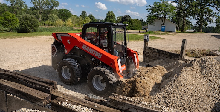
Chapter 4: Excavating & Loading
Chapter 5: Hauling
Chapter 6: Crushing & Hydraulic Breaking
Chapter 7: Screening
Chapter 8: Washing & Classifying
Chapter 9: Conveying & Material Handling
Chapter 10: Loadout & Weighing
Chapter 11: Safety & Health
IN THIS CHAPTER
Regions
Unfortunately, natural aggregates occur where nature placed them and not where people necessarily need them. Quality issues can limit the use of aggregates in every U.S. region, and conflicting land use, regulations, and social and economic factors can restrict the development of aggregate-producing sites.
Here’s a rundown of 12 U.S. regions and their unique rock characteristics:
Western mountain ranges
- Topography: Tall, massive mountains alternating with relatively narrow, steep-sided valleys. Larger valleys may have higher terraces.
- Crushed stone resources: Mountains are underlain by igneous and metamorphic rock and flanked by consolidated sedimentary rocks – including some limestone. The resources available are potential sources of high-quality crushed stone.
- Sand and gravel resources: Stream-channel or terrace deposits and limited glaciofluvial deposits are present. Quality problems tend to be localized.
&uuid=(email))
Basin and range
- Topography: Alternating basins or valleys and mountain ranges.
- Crushed stone resources: The mountain ranges are commonly underlain by igneous, metamorphic and consolidated sedimentary rocks. Potential sources of high-quality crushed stone are generally available.
- Sand and gravel resources: Large alluvial basins commonly contain extensive deposits of poorly sorted sand and gravel. Terraces and beaches on mountainsides, however, consist of well-sorted sand and gravel. Some areas are deficient in sand and gravel, and quality problems tend to be localized.
Columbia Plateau
- Topography: Gently sloping plateau underlain by a thick sequence of extensive lava flows separated by soil zones and interbedded sediments.
- Crushed stone resources: The northern part of the region is commonly underlain by basalt that is a potentially suitable source of crushed stone. The southern part is underlain by basalt and other igneous rocks – some of which have physical or chemical properties that do not yield good aggregates.
- Sand and gravel resources: Stream-channel, terrace and glaciofluvial deposits are well distributed throughout the northern parts of the region. In the rest of the region, sand and gravel are rather limited and commonly restricted to river and terrace deposits. Many gravel deposits have chemical and physical properties that do not yield good aggregates.
Colorado Plateau and Wyoming Basin
- Topography: High plateaus with deeply incised canyons, mountains, deserts and badlands. Erosion has produced extensive, prominent cliffs.
- Crushed stone resources: These are generally underlain by poorly consolidated to well-consolidated sandstone, shale and limestone, with the sandstone and shale being most prevalent and most extensive. In places, the rock units contain significant amounts of gypsum or halite. The soft sandstone and shale tend to afford poor quality crushed stone.
- Sand and gravel resources: Stream-channel, terrace and glaciofluvial deposits occur along parts of the major stream valleys – especially adjacent to the mountain ranges in the northern and eastern parts of the region. In the remainder of the region, sand and gravel is generally limited to alluvium and terraces. Gravel is commonly derived from the erosion of soft sandstone or shale, and it tends to be of poor quality.
High Plains
- Topography: Large, flat, gently eastward sloping plain. Significant topographic features include sand dunes and wide valleys of braided streams that flow from the Rocky Mountains eastward across the plain.
- Crushed stone resources: Bedrock consists of soft, semi-consolidated sediments – almost all of which is unsuitable for use as crushed stone.
- Sand and gravel resources: These include stream-channel and terrace deposits of the major rivers and their tributaries. Deposits are generally progressively finer downstream from the mountains and commonly deficient in coarse sizes. Gravels frequently have chemical or physical properties that do not yield good aggregates.
Nonglaciated Central Region
- Topography: Topographically complex region – including lowlands and plains, as well as hilly and mountainous areas.
- Crushed stone resources: Most of the northern part of the region and the part of the region flanking the Rocky Mountains is underlain by sedimentary rocks consisting of mostly sandstone, shale and conglomerate. Except for scattered limestone, these rocks are generally poor sources of crushed stone. Most of the south-central region is underlain by limestone and dolomite. These rocks commonly yield suitable sources of crushed stone, although the presence of chert and other deleterious minerals may restrict certain uses.
- Sand and gravel resources: The land surface in most of the region is overlain with a residual soil formed by the chemical and mechanical breakdown of bedrock. The residual soils in the western part of the region are overlain with substantial thicknesses of windblown deposits. Stream-channel and terrace deposits are the source of sand and gravel throughout the region. The quality of sand and gravel is variable and depends on the type of parent material.
PRO TIP
Check for Deleterious Minerals: Rocks with chert or reactive silica may cause issues in concrete and must be carefully evaluated.
Glaciated Central Region
- Topography: Flat plains, rolling hills and low-rounded mountains.
- Crushed stone resources: Bedrock consists of consolidated sedimentary rocks – including sandstone, shale, limestone and dolomite. These rocks are most prevalent in the central part of the area and less prevalent in the east. The western parts of the region generally lack limestone or dolomite and generally have inadequate sources of crushed stone. Throughout the region – even where suitable bedrock exists at depth – the thickness of overburden may be too great to extract rock economically.
- Sand and gravel resources: The major sources of sand and gravel are glaciofluvial, stream-channel and terrace deposits. Sand and gravel deposits are generally abundant throughout the region. In the northern part of the region, many aggregates are buried by fine-grained deposits. Aggregates are almost completely absent in the Illinois Coal Basin. Aggregates from the Missouri River tend to be contaminated with deleterious material from the underlying soft sandstone and shale bedrock. In the Great Lakes area and scattered throughout the region, aggregates may contain minerals with chemical properties that aren’t desirable for certain uses.
Glaciated Northeastern & Superior Uplands
- Topography: Rolling hills and low mountains.
- Crushed stone resources: The bedrock consists primarily of granite, syenite, anorthosite and other intrusive igneous rocks and metamorphosed sedimentary rocks consisting of gneiss, schist, quartzite, slate and marble. Most igneous rocks make suitable sources of crushed stone. The characteristics of metamorphic rocks vary widely, with the schists and slates commonly lacking the strength and shape characteristics for desirable crushed stone.
- Sand and gravel resources: Most of the valleys and other low areas commonly contain stream-channel, terrace and glaciofluvial sand and gravel. In several areas, the unconsolidated deposits consist of clay and silt deposited in lakes that formed during the melting of the ice sheets. The major sources of high-quality sand and gravel are glaciofluvial, stream-channel and terrace deposits.
Piedmont Blue Ridge Region
- Topography: The topography of this region is varied and consists of low, rounded hills and long, rolling ridges and mountains – with the highest peaks east of the Mississippi River.
- Crushed stone resources: The bedrock consists of igneous and metamorphosed sedimentary and igneous rocks – including granite, gneiss, schist, quartzite, slate, marble and phyllite. Granite and gneiss are commonly used as crushed stone, while schist, slate and phyllite are commonly avoided. Potential sources of high-quality crushed stone are generally available.
- Sand and gravel resources: The mountains are bordered by low-gradient streams flowing in relatively narrow valleys. The land surface is underlain by saprolite, which is clay-rich, unconsolidated material developed in place primarily from the chemical weathering of the underlying bedrock. The valleys are underlain by relatively thin, moderately sorted alluvium. Stream-channel and terrace deposits are the source of sand and gravel throughout the region. Quality problems tend to be localized.
Atlantic & Gulf Coastal Plain
- Topography: The topography ranges from extensive, flat, coastal swamps and marshes occurring near sea level, to rolling uplands occurring near the inner margin of the region.
- Crushed stone resources: Consolidated bedrock is generally inaccessible in the Coastal Plain region, except near the inner margin, and in southeast Florida, which is underlain by semi-consolidated limestones that are of marginal use as aggregates.
- Sand and gravel resources: The region is underlain with extensive deposits of semi-consolidated sand, silt, clay and gravel, with sand being the predominant surficial material. Most gravel deposits occur near the inner edge of the Coastal Plain and as stream-channel and terrace deposits. Deposits are limited in occurrence and are the primary source of natural aggregates in the region. Isolated deposits of beach and terrace gravels are scattered throughout the area. The quality of the gravels depends on the parent material. The gravels in the Atlantic coastal area tend to be high in quartz and other silica minerals, whereas those in the Gulf coastal area are calcareous. Coarse materials are so limited in this region that shells are commonly substituted for gravel. Sand and gravel occur in parts of the Mississippi embayment as isolated terraces. Sand and gravel also occur at depth under the alluvial clays of the Mississippi River floodplain.
&uuid=(email))
Alaska
- Topography: A complex area consisting of coastal plains, mountain ranges and intermontane plateaus.
- Crushed stone resources: These are underlain by a diverse assemblage of rocks. The principal mountain ranges have cores of igneous and metamorphic rocks. These are overlain and flanked by sedimentary and igneous rocks. The sedimentary rocks include carbonate rocks, sandstone and shale.
- Sand and gravel resources: About half of the region, including the mountain ranges and adjacent parts of the lowlands, was covered by glaciers. Glaciofluvial deposits in these areas commonly contain sand and gravel. In the intermontane plateaus, sand and gravel is commonly mined from stream channels, terrace deposits and placer-mine tailings. The Arctic Coastal Plain consists of silt, sand and gravel, with the northeastern part having moderate to high potential for sand and gravel. Many aggregates are frozen to some degree, and excavation requires drilling and blasting.
Hawaiian Islands
- Topography: Islands formed by lava that issued from one or more volcanic eruption centers. The islands have a hilly appearance, resulting from erosion that has carved valleys into volcanoes and built relatively narrow plains along parts of the coastal areas.
- Crushed stone resources: Each of the Hawaiian Islands is underlain by lava flows. Andesite and basalt flows are commonly used as a source of crushed stone. In addition, clinker from the tops of lava flows and cinders from cinder cones are used as stone aggregates.
- Sand and gravel resources: In some areas, alluvium of older and modern terraces and alluvial fans contain poorly sorted sand and gravel of variable quality. In coastal areas, a thin layer of coral and shell fragments, volcanic debris and clay form discontinuous beach deposits, which may be used as aggregates if they meet the required specifications.
FULL HANDBOOK
Chapter 1: Industry Overview
Chapter 2: Geology & Site Selection
Chapter 3: Drilling & Blasting
Chapter 4: Excavating & Loading
Chapter 5: Hauling
Chapter 6: Crushing & Hydraulic Breaking
Chapter 7: Screening
Chapter 8: Washing & Classifying
Chapter 9: Conveying & Material Handling
Chapter 10: Loadout & Weighing
Chapter 11: Safety & Health
IN THIS CHAPTER
Use the page numbers to continue reading, or select a section / chapter above.